Section 3 – mm 412-384
Since the road back to the Blue Ridge Parkway
was steep and windy, we decided to leave the trailer at Davidson River
Campground and drive the next stretch with just our car. Rain was predicted
midday, so we were hoping to hike before the rain arrived. We headed to Mt
Pisgah.
At 5,712ft, Mt Pisgah stands
out. Mt Pisgah (and Pisgah
National Forest) gets its
name from the Biblical mountain where Moses saw the Promised Land. Barbara
thought of her CBS Bible Study friends as they were studying Moses this year.
(There happen to be at least two Mt Pisgahs in Massachusetts.)
We took the 1.5-mile, 712
elevation gain trail to the summit. It started out gradual, but was steep near
the end.
 |
| the tower at the top |
We could see the storm
clouds coming in.
And it was very windy at the
top.
We scampered down the
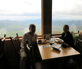
mountain and went to the restaurant at the Pisgah Inn before the rain rolled
in. The food was average and the service was slow, but the view was superb even
in the rain.
The rain continued, so no
more hiking today. We did drive a bit further to the main Blue Ridge Parkway visitor center for
information and the video.
campground: Davidson River
in Pisgah National Forest
Blue Ridge Parkway miles traveled: 23 miles today


