Section 2 – mm 443-412
We did the previous stretch
of the Blue Ridge Parkway
from our campsite in the Smoky
Mountains without the
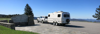
trailer, but now the trailer is with us as we picked up the Blue Ridge Parkway where we left off.
We stopped at overlooks
along the way.
We took the short Roy Taylor
Overlook Trail to a viewing platform.
 |
| Bill just fit |
We drove up, up, up to the
highest point on the Blue Ridge
Parkway – elevation 6,053ft.
Bill hiked the nearby
Richland Balsam loop. The trees in the mountain-top spruce-fir forest weren’t
that tall.
The cliff in the picture
below is called Devil’s Courthouse. We hiked up to a viewing area on the top of
the cliff.
Here’s the view.
After we hiked down from
Devil’s Courthouse, we chatted with a backpacking couple with a dog. They were
taking several months to do the 930-mile Mountain-to-Sea Trail.
It starts at Clingmans Dome,
follows close to the Blue Ridge
Parkway, and then turns to the North Carolina coast, eventually ending at
Jockey’s Ridge on the Outer Banks. (We’ve been at both ends.) Wow. What an
adventure! They were still smiling after 100 miles.
We stopped at the Graveyard
Fields Overlook where we hiked down the steep .4-mile trail to Second Falls.
 |
| Bill on rocks at the base of Second Falls |
Then Bill continued on to
the Upper Falls, a 2.5-mile round-trip.
This section of the Blue Ridge parkway overlooks national forests and has
spectacular scenery and viewpoints.
Most of the parkway
campgrounds aren’t open yet, so we turned off the parkway, taking steep, windy
US-276 to a National Forest campground. On the way we stopped at Looking Glass
Falls.
campground: Davidson River
in Pisgah National Forest
Blue Ridge Parkway miles traveled: 31 miles today


