Tuesday, October 30, 2018

California – Big Sur to Morro Bay


The beginning of our drive from Big Sur to Morro Bay still had windy coastal roads and lots of scenic vistas.

He might be hard to see, but Bill is perched on the center of the closer rocks in the picture. He hiked down and then scrambled up some rocks to get there.


At San Simeon the road leveled out. We saw a parking area with lots of cars and saw another Escape 19 pull in. We decided to check it out – hoping for room for 2 trailers. We met the other Escape owners – a couple from Vancouver with a 2012 Escape 19 who gave us some tips on Joshua Tree National Park. The parking lot was for Elephant Seal Vista Point with a beach full of seals. Here’s a cute one.


Barbara had a letterboxing series that she wanted to find that was along our route. She liked this particular clever hide in a carved out wood block identical to a block supporting a board edging the trail.
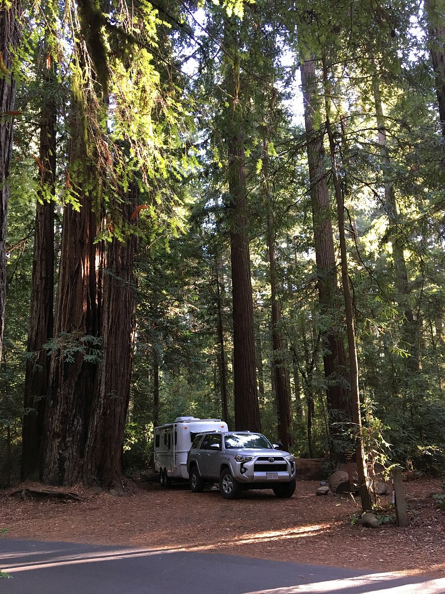
We camped at Morro Bay State Park where the most striking feature of the area is Morro Rock a 576-foot high volcanic plug.

It originally was surrounded by water, but when they dredged the harbor they built a causeway - now one can drive out to it and walk partway around the rock. We walked around Morro Rock, watched waves crashing over the breakwater, spotted otters playing, and walked the beach.


It was really hard to get good pictures of the otters, but they were fun to watch.


Then we said good-bye to the Pacific.


Monday, October 29, 2018

California – Big Sur


Big Sur is the 90-mile stretch of scenic highway from Carmel to San Simeon. It’s a windy drive over treacherous turns with steep drop-offs, but has incredible views. It was closed for 14 months due to a landslide, but fortunately reopened in July.

On the left side in the picture below is the 80-foot high McWay Falls, California’s only coastal waterfall that drops straight into the sea.
We took a half mile hike down to Partington Cove in Julia Pfeiffer Burns State Park. The trail took us to two parts. To get to the first part we went through a tunnel.

Here’s the view on the other side of the tunnel

We had lunch here.
 
The second part took us to a rocky cove.
 
The lighting was great at the end of the day.
The Bixby Bridge
We saw this guy painting the scene and he was fine with us taking a picture of him.


We enjoyed seeing the sunset.


Sunday, October 28, 2018

California – Point Reyes


We drove to a Sonoma county campground on a jetty in Bodega Bay where we heard the sounds of waves and fog horn through the night. Here’s the beach that was a stone’s throw from our campsite.

We spent a day exploring Point Reyes National Seashore. We started with a hike down to McClures Beach. After one other couple left, we had the beach to ourselves.

Then we hiked along Tomales Point Trail looking for Tule Elk. Bill went ahead, as usually the elk are further along the trail, but didn’t see any. Barbara, further back, saw 2 herds, one running. We also saw a coyote.

We couldn’t visit the lighthouse due to renovations, but we went to the visitor center and watched their video. We walked along the Earthquake Trail with interpretive signs explaining how the park lies on the San Andreas Fault. A fence along the trail illustrates the 16 feet displacement that occurred during the 1906 San Francisco earthquake.
2 sections of fence were attached before the 1906 earthquake

Then Bill went on a long hike down to a bluff overlooking the ocean.

Barbara went on a short hike by wetlands and then went to the beach.

We saw other wildlife: deer, a snake, butterflies, and all sorts of birds and ducks. This might be a Northern Harrier or a Cooper's Hawk. (Thanks, Dad, for the tip!)
As Barbara was going to pick up Bill she saw a couple hitchhiking. They had hiked down to the beach from a parking lot high on the mountain. She picked up Bill, too, and drove them back to their car. They worked for awhile on a goat farm in California and were taking a leisurely trip back to their home state of Washington.

Then as we were driving back “home” along a long bayside road with few houses and even fewer businesses, we saw two guys walking in the opposite direction carrying a gas can. We asked if they needed a ride somewhere. The father and son had come ashore in a dingy from a sailboat to get gas and had walked about 3 miles. We knew there wasn’t a gas station in over ten miles in either direction, but we offered to give them a ride to find some. Several miles down the road we found a fisherman who had gas and we drove the guys back to their dingy. It turns out that they along with a wife and daughter live on their 42-foot sailboat. We wish them well as they sail south.

Friday, October 26, 2018

California – Avenue of the Giants


We headed further south and a little inland to Humboldt Redwoods State Park. This park has the largest remaining old-growth redwood forest in the world. It gets 80 inches of rain from October to May, which is great for the trees. Lucky for us we only got a few drops of rain while we were there.

We drove the 30-mile Avenue of the Giants – another road through towering trees – and we camped again amongst the redwoods.

No electricity at these California state park campgrounds, but that is okay as our trailer has propane heat and solar panels.

We went on a number of small hikes. The first was the Founders Grove Trail. Lots of tall trees here.
We saw quite a few burned out trunks, but the trees still seemed to be alive. Who’s photographing whom?
The Dyerville Giant was one of the Champion redwood trees at about 370 feet tall (200 feet taller than Niagara Falls!), but fell in 1991. It’s hard to even spot Bill at the other end of this fallen giant.
Here’s the root ball of another fallen tree. These woods had quite a few fallen trees.
We went on a few other short hikes. One went to the Giant Tree; another went to Tall Tree. They all seem Big, Giant and Tall to us.
Humboldt Redwoods State Park is the home of the 4th tallest known tree (which we didn’t see) and was the tallest from 2000-2006 until the discovery of taller trees in Redwood National Park. Barbara read an interesting article on the tallest trees about a decade or so ago. They now prefer not to make the tallest trees tourist attractions, which we think is a good idea.


We loved our walks amidst the big trees.

Tuesday, October 23, 2018

California – Redwoods


Being off season, we had no problem getting a site at Jedediah Smith Redwoods State Park where we camped below towering trees.

Three state parks in northwest California (Jedediah Smith, Prairie Creek & Del Norte) were created to protect the Redwoods in the 1920s. In 1968 Redwoods National Park was created, encircling the state parks further protecting the forest.

We left the trailer at the campsite and drove the windy, narrow, dirt Howland Hill Road through the redwood forest – a little challenge when a car was coming in the opposite direction. It was cool driving through the forest, squeaking between trees.

We followed the road to Stout Grove where we took the short Stout Grove Loop Trail – Jedediah Smith’s most famous redwood stand. Periodic flooding prevents underbrush from growing, forming a fern carpet forest floor.

The Coast Redwood can grow to almost 380 feet and can live 2,000 years. These are some big old trees!

Can you spot Bill?


The next day we drove further down Howland Hill Road to the Boy Scout Tree Trail. On the way we found a pretty big stump where Barbara found her first California letterbox. We decided not to count the rings.

The Boy Scout trail is a pristine 5.6-mile round trip hike into the heart of the park.

We had the trail practically to ourselves until we got to the Boy Scout Tree where we met couples from South Carolina and Florida. We took pictures of each other by the tree. On the way back we met a couple from Virginia – lots of east coasters on the trail!

Later on we drove another redwood-lined road - Newton B Drury Scenic Parkway in Prairie Creek Redwoods State Park. Barbara checked out the visitor center while Bill hiked Prairie Creek and Cathedral trails.

Prairie Creek trail hugged the creek and had both big trees and good views of them. The loop back went by Big Tree which used to be one of the tallest until the top blew off in a storm.