Tuesday, November 21, 2017

Kings Mountain Summary


We spent three months volunteering at Kings Mountain National Military Park in Blacksburg, South Carolina, giving us a chance to give back to the National Parks in a small way by helping where we could.
This park preserves and interprets a brief moment in our nation’s history – a Revolutionary War battle that took about an hour, but became a pivotal link in the chain of events that led to winning the war and founding our country. Working at Kings Mountain immersed us in the history of the era and the often-overlooked southern campaign of the war.
Bill leading a guided battlefield walk
Barbara taught students how to make candles.
Bill participated in black powder weapons demonstrations.

While working at Kings Mountain, we also got the opportunity to explore the region. Visiting other Revolutionary War sites put the Battle at Kings Mountain into context and gave us a chance to observe the different ways the parks interpret history.

Most visitors to Kings Mountain National Military Park wanted to learn about the history, but some people wanted to hike. We hiked pretty much all the local trails, so we were able to give a good description of the options. Here’s 
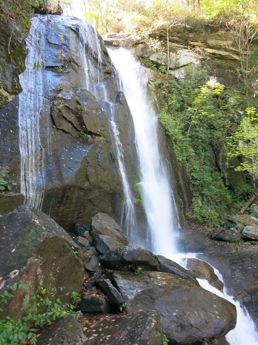
the view from Kings Pinnacle, which may be the most scenic hike near Kings Mountain.

The local hikes were good, but our favorite thing to do on our days off was to drive over an hour to the edge of the Blue Ridge Mountains and hike. We got to see some beautiful places in the Carolinas.
 
Also we attended a Community Bible Study class. Barbara’s been involved with CBS for over 20 years, so was glad to hear of a new evening co-ed class in the area. We got to study the Bible weekly and still be available to work weekends. We pray for special blessings to our core leaders and the Servants Team as they continue their first year as a CBS class!

One thing we learned while working at Kings Mountain was a quote by Maya Angelou that Ranger Adrian shared with us.
Being a volunteer with the interpretive rangers brought us face to face with visitors. We shared the history, but tried most of all to make them feel good about their experience at Kings Mountain. Like one time when a couple drove all the way from Florida just to see Kings Mountain, but were disappointed that the monuments weren’t handicap accessible. Bill wanted their time to be memorable, so spent extra time with them and pulled out the guns giving them a private weapons talk.

It amazed us to see the varieties of reasons people walked through the door. Some came for history, some for a walk in the woods, some to visit yet another National Park, some as it is their regular place to hang out, some to buy a senior pass, some because they had ancestors in the battle, and some didn’t know why they came, but saw the sign and thought they ought to check it out. Every once in a while we would hear their stories.
Photographer Bart Smith hiked almost all the National Scenic & Historic Trails (28,000+ miles).
Clyde, a regular visitor, is writing a book about Kings Mountain.
We even met a bear who visits National Parks.
We got to know the rangers a bit, too, and appreciate all they did to help us out. They took us out to eat on one of our last nights. And it felt like a fitting end that on our last full night we heard the Kings Mountain story around a campfire.

Monday, November 13, 2017

South Carolina – Historic Camden


With dreary weather on our day off, we decided it would be better not to hike, so we drove two hours to another place associated with the Revolutionary War – Historic Camden.
Camden is the oldest inland town in South Carolina. Historic Camden includes over 100 acres of the original town land with a small museum, reconstructed military fortifications, and a handful of period homes. We missed the guided tour, but were able to explore the place on our own.
the Bradley House contains historical displays

The cap below caught our eye. Our friend and former Kings Mountain volunteer, Karen, knit similar caps for the Kings Mountain rangers.
reconstructed redoubt (fortification)
the reconstructed Kershaw House (Cornwallis’ headquarters)

Two Revolutionary War battles were fought in this area. The first chronologically is the Battle of Camden.
In the summer of 1780, after taking over Charleston, the British started a plan to sweep through the south. The Continental army, led by General Horatio Gates, aimed to stop this sweep by attacking the British at Camden, but the British were tipped off and attacked the exhausted Continentals first. The result was a great loss for the Continental troops and Gates’ marred reputation for having fled the battle.
The battle area was only recently acquired by the historic park, but due to earlier preservation efforts some trails and signs commemorate the battle.

The other battle in the area was the Battle of Hobkirk’s Hill where 8 months later Continental General Greene occupied a hill north of Camden threatening the British garrison at Camden.
His troops were surprised by a British attack. Greene launched a counterattack, but the Brits took the hill and drove the Continental troops away. Despite these defeats, other battles like the one at Kings Mountain pushed things toward an eventual surrender by the Brits.
Signs amidst the neighborhood and in a small park commemorate the battle.

The areas could use some further development, but the history adds to our timeline of Revolutionary War events in the south.

Thursday, November 9, 2017

South Carolina – Kings Mountain – Hidden Places

Because we worked at Kings Mountain National Military Park, we discovered some hidden places that the typical visitor doesn’t see.

THE HOWSER HOUSE
Many weeks into our time at Kings Mountain, Barbara responded to a Howser House question by saying something like “You must have the wrong park...” Fortunately the bookstore manager, Wilma, stepped in to say the house (which Barbara had never heard of before) is in the park and shown only twice a year by the Brigade of Friends of Kings Mountain. The house is not on the park map and is only advertised near its Open House.

The house is on the aptly-named Rock House Road, but a locked gate and long driveway hide it from the road. Rare in this area, a stone house generally showed a sign of wealth.

The lintel above the door indicated that the owner, Henry Howser, was a stone mason and built the house in 1803.

It was cool to also see a fence that a Boy Scout troop built a few weeks ago for a service project.

There is another hidden place nearby– the Howser Family Cemetery. Bill spotted it on a knoll 200 yards or so from the house.
This tiny cemetery has 9 grave stones and is pretty easy to miss unless one is looking for it.

A STRUCTURE IN THE WOODS
Another hidden discovery came about when Bill noticed an unidentified structure on a detailed topographical map given to the park by an orienteering group. On one of his morning walks to work, he detoured through the woods to find it. It’s not far from the battlefield trail and the backcountry trail, but hidden from both.

It’s the old pump house that used to provide water to the park. Not an exciting discovery, but it was interesting to figure it out.

SIGN
Then we had another discovery. Bill told the maintenance worker, Andy, that he cleaned all the signs. Andy grinned and said Bill missed a sign. Decades ago, a park trail went by this sign. Not any more!
It was a bit of a bushwhack, but we found it.
an abandoned sign about Winston’s militia
HIGHEST POINT
We passed the Employees Only sign and trudged up the gravel road to the water tower. A ranger told us this is the highest point in the park. On this foggy morning, we saw the hazy views between the trees.
 
OUR CAMPSITE
The last spot we will mention is the RV pad for our trailer, since it is hidden from park visitors. The park has two 1950s-era houses and one RV pad. A law enforcement ranger, Caleb, and his wife live in the left house and the other house has been empty except two weeks when another volunteer, Bob, stayed there.
This hidden spot was our home for three months.

Saturday, November 4, 2017

North Carolina – South Mountains State Park


Bill learned about South Mountains State Park from a visitor to Kings Mountain. It is only about an hour away – just on the edge of the mountains region of North Carolina. A topographical map in the visitor center gave us an idea of the terrain.
The park contains miles of hiking trails, but we targeted the highlights: a waterfall and two overlooks. We headed on the one-mile trail to High Shoal Falls. The trail started out flat and wide following the cascading Jacob Fork River.
In the image above, Bill is preparing to take the photo shown below where the Shinny River (pronounced “shiny”) joins the Jacob Fork River.

The trail got steeper and rockier as we approached the falls with interesting geology including a 1989 (Hurricane Hugo) rockslide across the trail. Signs along the trail explained the geology.

Barbara spotted a little man-made pile of rocks amidst the cascades that Bill willingly scrambled to photograph.

The trail led to a close up view of High Shoal Falls.
The cool thing was that we had the falls all to ourselves. Part way back we came upon a boisterous school group heading for the falls. Glad we got there when we did!

On the way back we took the Chestnut Knob Trail, a spur trail to two overlooks. We hiked up, up, up 0.7 miles to Jacob Fork River Gorge Overlook where a break in the trees allowed a very distant view of High Shoals Waterfall.
Bill continued another 1.1 miles to Chestnut Knob Overlook, a rock outcropping where one could see for miles. Bill could even spot Charlotte in the distance.
 
In the meantime, Barbara headed back down, down, down. Then she went on the Hemlock Nature Trail that hugged the gurgling river.

Another nice hike on a beautiful fall day!